


Project Overview
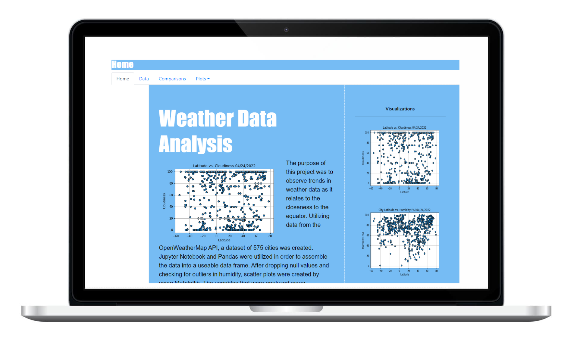
The purpose of this project was to observe trends in weather data as it relates to the closeness to the equator. Utilizing data from the OpenWeatherMap API, a dataset of 575 cities was created. Jupyter Notebook and Pandas were utilized in order to assemble the data into a useable data frame. After dropping null values and checking for outliers in humidity, scatter plots were created by using Matplotlib. The variables that were analyzed were: Cloudiness level, Humidity, Max Temperature, and Windspeed.
This website provides access to source data, visualizations of the data, as well as analysis and description of any observable trends and correlations of the data.